


Stanglwirt hotline+43 (0)5358 2000Call now
Guided walks at the Stanglwirt
Some hiking destinations

A short mountain walk near the picturesque Hintersteiner See mountain lake. At the start of the route, an average-difficult woodland path takes you through a remote and romantic mixed forest to a forest track that leads to the Walleralm alpine pasture.
Just before the mountain hut, you have the opportunity to take a short diversion (max. 15 mins) to climb up to the Kreuzbichl and so enjoy the satisfaction of reaching a summit and a stunning panorama. On the way down, you follow a different route and arrive at the far end of the lake, before walking along its southern shore back to your starting point.
What you need to take & know
- The right equipment for the time of year and the weather conditions, but with deep-tread shoes as a minimum requirement (rucksack, drink, change of top, jacket, pullover, hat, gloves)
- Fitness: Average fitness is sufficient (this means you can walk briskly for 2 hours on the flat without stopping)
- Technical difficulty: You need to be quite sure-footed in the forest (lots of roots and some stones)
- Ascent: 350 m vertical distance - approx. 1 hr 20 min.
- Descent: approx. 1 hr 10 min.
- Total duration: approx. 4 hours (including a stop at the mountain hut)
The Baumgartenköpfl rises high above Going, at the foot of the mighty crags of the Regalpspitze, and is one of the few peaks which can be reached on a normal footpath.
An average-difficult mountain tour which takes you to one of the best viewpoints in the whole Kaiser mountain range. The panorama extends from the Lofer Mountains, over the glacier-topped giants of the High Tauern, with the Grossglockner (3798 m) and the Grossvenediger (3674 m), as far as the Kitzbühel Alps and the Zillertal Alps. The hotel bus takes you to the start on the Wochenbrunner Alm, from where you walk to the Gaudeamus mountain hut (about 35 mins) and then on a somewhat steeper, average-difficult mountain path to reach the summit in about 1 hour.
You descend on the other side via the Regalm pasture to the Graspoint Niederalm pasture and then on to the Hüttling car park (Aschau).
What you need to take & know
- The right equipment for the time of year and the weather conditions, but with deep-tread shoes as a minimum requirement (rucksack, drink, change of top, jacket, pullover, hat, gloves)
- Fitness: Average fitness is sufficient (this means you can walk briskly for 2 hours on the flat without stopping)
- Technical difficulty: You need to be sure-footed on stony ground!
- Ascent: 480 m vertical distance - approx. 1 hr 35 min.
- Descent: 750 m vertical distance - approx. 2 hrs.
- Total duration: approx. 5 hrs 30 mins (incl. stop at the summit, break for refreshments and bus transfer)
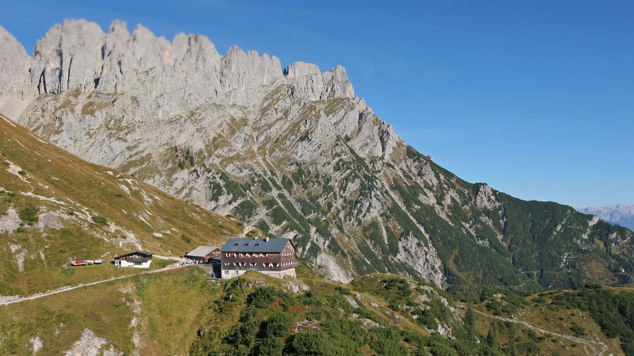
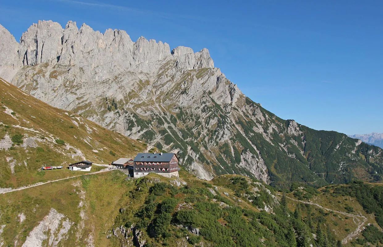
The Grutten mountain hut is situated like an eagle's eyrie high above Ellmau and, from its breezy terrace, visitors can enjoy a breathtaking panoramic view.
The hotel bus takes you along a turnpike road to the Wochenbrunner Alm, from where a wide but steep path leads first of all through a beautiful beech forest. About halfway through the climb, you emerge out of the trees and can enjoy the view even as you continue uphill.
Towards the end you have to cross a few fields of scree and go through some rocky passages where you need to be quite sure-footed. The best way down is the far easier path towards the Riedl hut, then you can have another short stop at the Ellmau stone circle to get your strength back before enjoying the easy 30-minute walk back to the Wochenbrunner Alm.
What you need to take & know
- The right equipment for the time of year and the weather conditions, but with deep-tread shoes as a minimum requirement (rucksack, drink, change of top, jacket, pullover, hat, gloves)
- Fitness: Average to good fitness is required (this means you can walk briskly for 2 hours on the flat without stopping)
- Technical difficulty: you need to be quite sure-footed for the higher part of the walk
- Ascent: 2.5 km - 530 m vertical distance - approx. 1 hr 45 mins.
- Descent: approx. 1 hr 30 mins
- Total duration: approx. 4 hrs 30 mins
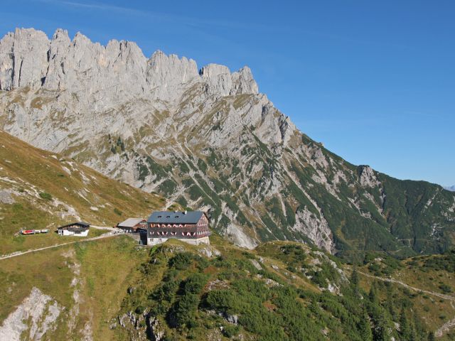
Grüttenhütte on the Wilder Kaiser
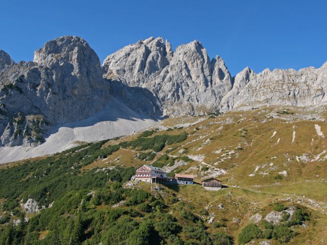
Grüttenhütte on the Wilder Kaiser - summer

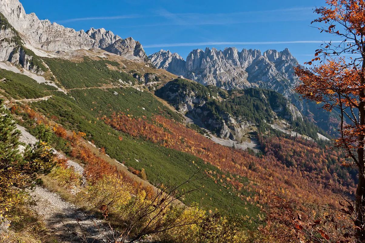
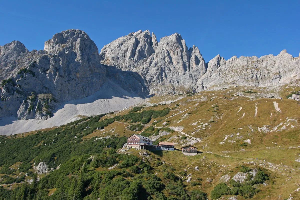
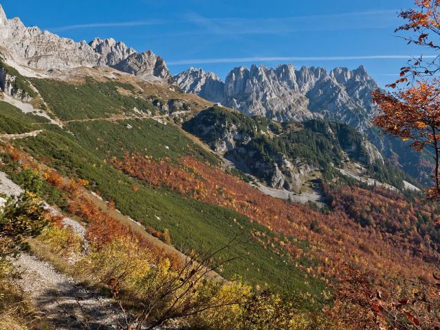
The saddle above the vast and unmistakeable scree-covered cirque directly behind Ellmau is called the Ellmauer Tor. Here a "normal" mountain path takes you to the other side of the Wilder Kaiser.
This enormous hollow, filled with scree and boulders, is bordered by the vertical cliff faces of the Karlsspitze and the Törlspitze, giving you the sense of a true alpine experience even as you ascend.
The starting and finishing point for this tour is the Wochenbrunner Alm pasture at 1085 m.
First of all, a wide forest track takes you up to the Gaudeamus hut before a mountain path winds its way in countless twists and turns up through a pine forest. From about 1600 m, the going becomes rather more difficult, on rocks and scree. As you pass through a rocky channel, there is a short section (about 100 m) which is secured with a cable.
However, after the difficult climb up on the rubble and boulders, the experienced climber is rewarded with perfect rubble-filled channels which they can enjoy walking down.
You need to be fit and very sure-footed for this hike, and wear good walking boots (preferably high-cut). You also need to be sure to take sufficient water, because there are no water sources after the Gaudeamus hut.
What you need to take & know
- Requirements: The right equipment for the time of year and the weather conditions, but with deep-tread shoes as a minimum requirement (rucksack, drink, change of top, jacket, pullover, hat, gloves)
- Fitness: Average to good fitness is required (this means you can walk briskly for 2 hours on the flat without stopping)
- Technical difficulty: you need to be quite sure-footed for the higher part of the walk
- Distance: 7 km
- Difference in altitude: 900 metres
- Duration: approx. 4.5 hrs


